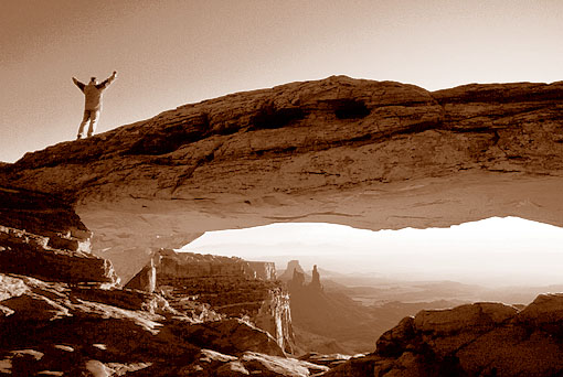
At first there were the pictures which caught my eye. Unfortunately there was no information where to find this location with the promising name Marlboro Point (if you know the advertising of Marlboro, years ago). It was obvious that Marlboro Point is somewhere in the area in or around Canyonlands National Park, however this area is pretty large.
My next trip to the Southwest of the USA was immediately approaching and therefore I was keen to find out where Marlboro Point is. Searching the Web surprisingly led to a German website, namely the site www.westernskies.de of Bjoern. Hence, I sent a short email to him, asking for information how to get to Marlboro Point. However, before I got a response from Bjoern, I found another website IntrepidXJ’s Adventute Blog where even the GPS-track to Marlboro Point could be downloaded. Shortly after I got a response from Bjoern with the requested information and he was also surprised that one could download the track to Marlboro Point.
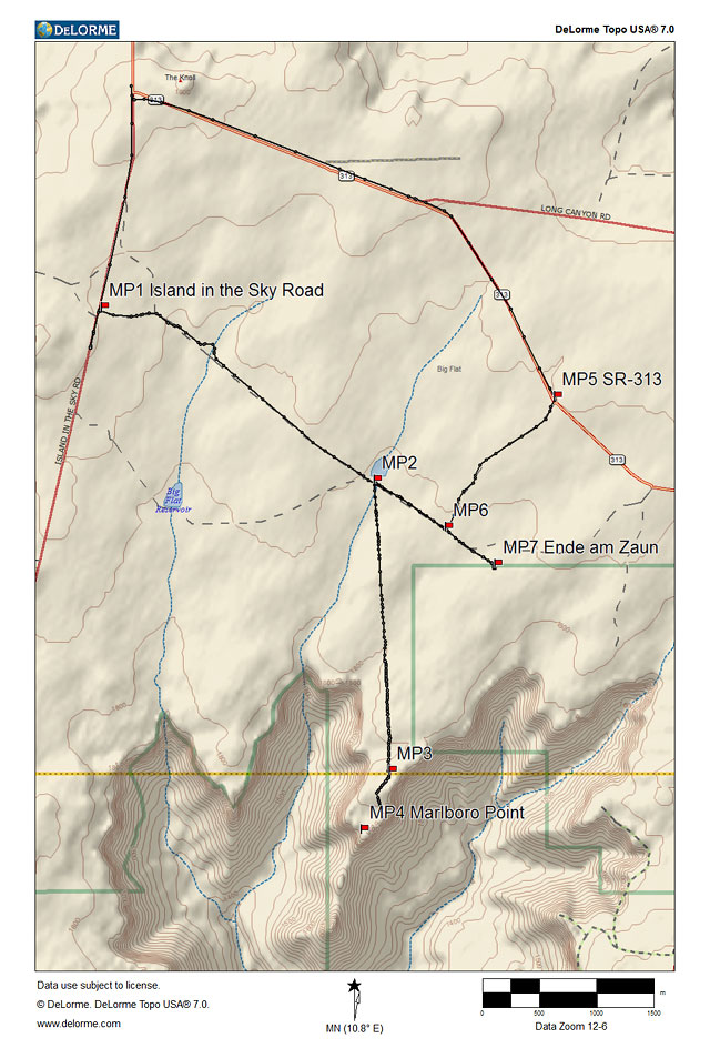
Here you can download my track and the waypoints (.gpx)
Checking the dirt roads
Marlboro Point is located in Big Flat, an area between Dead Horse Point State Park and Canyonlands National Park (Island in the Sky). You can get there via different dirt roads, either from highway UT-313 (via MP5) leading to Dead Horse Point State Park, or from Island in the Sky Road (via MP1) leading to the Canyonlands National Park entrance of the correspondent district. No matter which dirt road you take, you will finally come to the same rather rough dirt road (MP2) heading south to Marlboro Point. The first part of the route towards MP2 leads over clay roads which may be impassable if they are wet. During my visit to Marlboro Point in March the roads were dry but with rather deep tracks and it seemed to be advisable to use a high-clearance vehicle – no problem for my Jeep Liberty.
As I already knew from reports I found in the Web, the route to Marlboro Point was rather time consuming. Hence, I first checked the dirt roads at daylight to get a feeling how much time I would need to get to Marlboro Point for sunrise shots. The first part was rather easy but shortly after reaching the dirt road heading south (MP2) the road became rough and part wise rocky. Deep tracks in the dried mud alternated with rocky parts and I could not drive much faster than walking speed. The idea to drive along this dirt road in darkness to get to Marlboro Point before sunrise caused some headache to me. Fortunately this dirt road is only about 3 miles long.
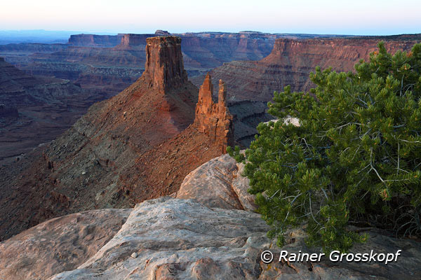
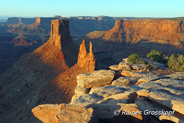
It was an overcast day and around lunch time when I first visited Marlboro Point, but nevertheless I was deeply impressed by the gorgeous view. A typical view you would expect when you think of Marlboro advertisement. The best idea would be to stay overnight in order to take pictures at sunset and at sunrise the next morning, however it was March and the night temperatures would be below freezing - I was not equipped for winter camping. There was a “no camping” sing but it was not quite clear to me to which area the prohibition referred. It was obvious from the many fireplaces that people had camped in this area. At least a few hundred yards away from the rim camping should be possible and allowed.
Getting up at 4:30 am
I stayed in Motel 6 in Moab, where you could get a room at this time of the year for less than 40 dollars. Sunrise was around 7 am and you should calculate with approximately 2 hours getting from Moab to Marlboro Point. That means getting up at 4:30 am, buying a coffee at the gas station and off it goes. When I started at the motel I saw some stars at the sky and hoped for a good sunrise. Unfortunately the clouds got thicker and thicker while I was driving towards Marlboro Point and the few gaps between the clouds vanished. Even before I reached the dirt road I decided to break off. It seemed that the sun would have no chance against the thick clouds in the east. Fortunately I was right because it would have been annoying if suddenly a magnificent sunrise with dramatically colored clouds would have happened.
Second trial
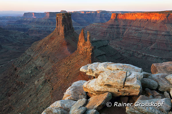
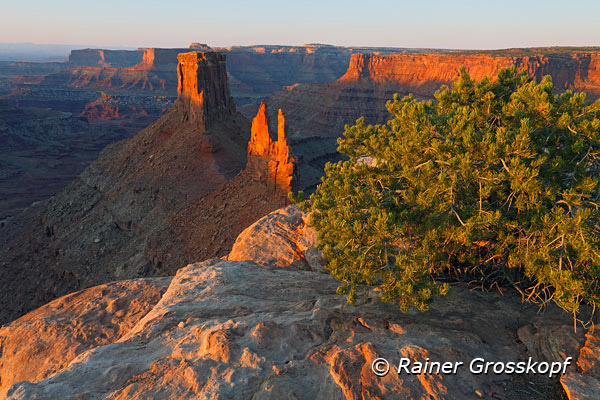
The same procedure the next morning, but this time there were no clouds at the sky. A sky without clouds is not the best scenario for a photographer however the chance for a photogenic sunrise was much better today than the day before. Forty-five minutes later I reached the dirt road and it took another few minutes to get to the point (MP2) where the dirt road heading south starts. It was still dark without moonshine and I decided not to drive the rough dirt road under these circumstances. About 3 miles can be easily done in an hour by foot and the road, respectively trail, was rather flat. Hence, I took my camera backpack, gloves and a cap because it was rather frosty, the tripod and one hand, and off I went. I hiked rather fast to get warm and even in the darkness it was no problem to follow the dirt road. Right in time, about 15 minutes before sunrise, I arrived at the rim at Marlboro Point.